Page 2 of 4 FirstFirst 1234 LastLast
Results 21 to 40 of 65

Thread: Beautiful maps of SSHIP: let's visit Iran

  1. #21
    Lifthrasir's Avatar "Capre" Dunkerquois
    Patrician took an arrow to the knee

    Join Date
    Jan 2010
    Location
    City of Jan Baert
    Posts
    13,950
    Blog Entries
    4

    Default Re: Beautiful maps of SSHIP: let's visit Iran

    I found the same info already but I'd like to find something about the population number. The other thing is the is made as a fortress/citadel, it would give a huge advantage to the faction able to conquer it. We need to consider the gameplay and balance a as well.
    Under the patronage of Flinn, proud patron of Jadli, from the Heresy Vault of the Imperial House of Hader

  2. #22

    Default Re: Beautiful maps of SSHIP: let's visit Iran

    Your idea about castle is good Lifth althought if Kermansha was a important centre of trading and interchange of resources and people should be a city no?
    THE MORE YOU SWEAT NOW,
    THE LESS YOU BLEED IN BATTLE!!!


    Sign the petition to remove hardcoded limits for M2TW

  3. #23
    bigdaddy1204's Avatar Campidoctor
    Join Date
    Mar 2007
    Location
    Dar al-Islam
    Posts
    1,896

    Default Re: Beautiful maps of SSHIP: let's visit Iran

    The secret to success I think would be recruitment. For example, the city of Hasankeyf is only a castle, but it gives recruitment options to many interesting and useful units. Kermanshah is one of the centres of Kurdish civilisation; it would be cool to be able to train units like Kurdish swordsmen and peshmerga cavalry in their homeland.

  4. #24

    Default Re: Beautiful maps of SSHIP: let's visit Iran

    I agree about kermanshah and kurdish swordsmen. Can u tell me what is peshmerga cavarly ? I guess kurdish heavy cavarly. If so, i would realy love to see them. Salah ad din used them, they had they're faces covered in mail if i remember well.

  5. #25
    Lifthrasir's Avatar "Capre" Dunkerquois
    Patrician took an arrow to the knee

    Join Date
    Jan 2010
    Location
    City of Jan Baert
    Posts
    13,950
    Blog Entries
    4

    Default Re: Beautiful maps of SSHIP: let's visit Iran

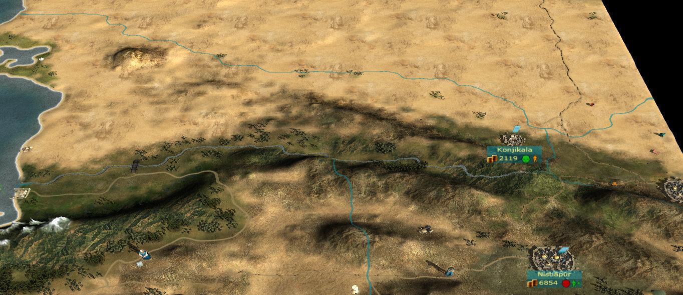
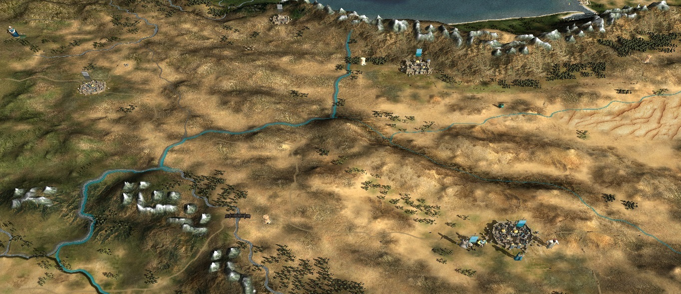
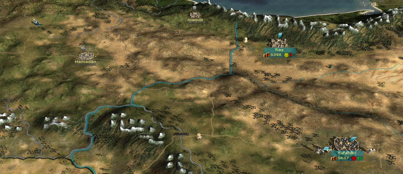
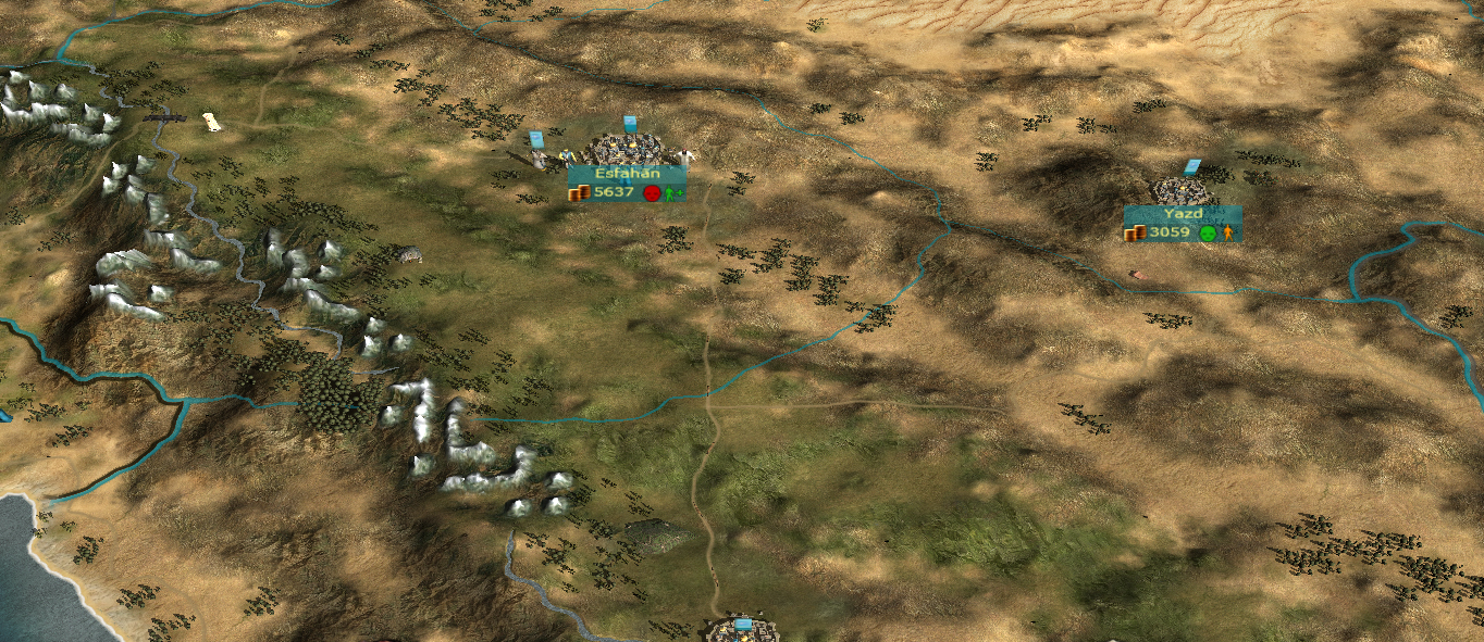
    This is what I found about Kermanshah:

    Quote Originally Posted by Encyclopaedia Iranica
    Under the Saljuqs, Kermanshah was still militarily and economically important because of its location at the intersection of the great highway linking Baghdad to Khurasan with a trade route to Tabriz and Ardabil (Lambton, 1968, p. 222). For much the same reason, the region became a bone of contention in regional conflicts that punctuated the history of Iran beginning in the 12th century. In 1197-98, the Chorasmian emir Miānjoq plundered Kermanshah (Rāvandi, p. 398). Kermanshah was on Hulāgu’s line of march from Hamadan towards Baghdad, and in December 1257 his army devastated the town and massacred its inhabitants (Boyle, p. 347). Thus, by Mostawfi’s time (ca. 1340), what had been a medium-size town was merely a village (Nozhat al-qolub, ed. Le Strange, p. 108; tr., pp. 106-7).
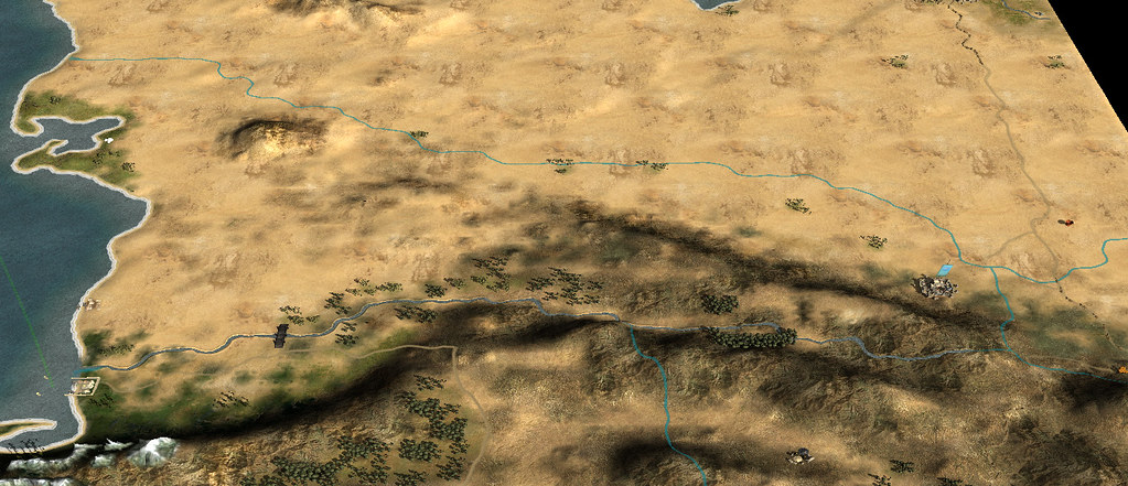
    I've put in bold the interesting info. So, considering that Konjila is a castle, if it is replaced by Kermanshah then it will be a castle or a town.
    Under the patronage of Flinn, proud patron of Jadli, from the Heresy Vault of the Imperial House of Hader

  6. #26
    Lifthrasir's Avatar "Capre" Dunkerquois
    Patrician took an arrow to the knee

    Join Date
    Jan 2010
    Location
    City of Jan Baert
    Posts
    13,950
    Blog Entries
    4

    Default Re: Beautiful maps of SSHIP: let's visit Iran

    After discussion, we (SHIP team) have decided that there won't be any settlement change for now. Kermanshah won't be added.
    Under the patronage of Flinn, proud patron of Jadli, from the Heresy Vault of the Imperial House of Hader

  7. #27
    bigdaddy1204's Avatar Campidoctor
    Join Date
    Mar 2007
    Location
    Dar al-Islam
    Posts
    1,896

    Default Re: Beautiful maps of SSHIP: let's visit Iran

    OK, I understand.

    What about the climate/greenery of Iran?

    @achilles91: my apologies, I was mixing things up, peshmerga cavalry are a unit in Broken Crescent.

    @Lifthrasir: I just wanted to say thank you. SSHIP is one of the most played games on my PC, whether things go how I want or not it's still one of the greatest games. Hooray for SSHIP!

  8. #28
    Lifthrasir's Avatar "Capre" Dunkerquois
    Patrician took an arrow to the knee

    Join Date
    Jan 2010
    Location
    City of Jan Baert
    Posts
    13,950
    Blog Entries
    4

    Default Re: Beautiful maps of SSHIP: let's visit Iran

    The reason why we disagree to add Kermanshah is that we're convinced that in wouldn't add anything to the gameplay due to its location. As MWY pointed out, at least Konjikala has a mnior use once he Mongols appear.

    The climate map will be slightly changed but I won't guarantee it for the next release.

    And thanks for your kind words
    Under the patronage of Flinn, proud patron of Jadli, from the Heresy Vault of the Imperial House of Hader

  9. #29

    Default Re: Beautiful maps of SSHIP: let's visit Iran

    Now that that's been discussed, more pics plz

    Seriously, those photos are incredible!

  10. #30
    Lifthrasir's Avatar "Capre" Dunkerquois
    Patrician took an arrow to the knee

    Join Date
    Jan 2010
    Location
    City of Jan Baert
    Posts
    13,950
    Blog Entries
    4

    Default Re: Beautiful maps of SSHIP: let's visit Iran

    I don't think that this is the right place for it if it is just to see pics without any relating purpose linked to the mod. From my point of view, the Travelers' Lodge would be better
    Under the patronage of Flinn, proud patron of Jadli, from the Heresy Vault of the Imperial House of Hader

  11. #31
    bigdaddy1204's Avatar Campidoctor
    Join Date
    Mar 2007
    Location
    Dar al-Islam
    Posts
    1,896

    Default Re: Beautiful maps of SSHIP: let's visit Iran

    Well, the main reason I created this thread was to get the campaign map scenery improved to a more realistic look, in the same way we did with Iraq before, which was very successful. The discussion about Kermanshah was much less important than the overall look of the scenery in the region. Today, when I play in Iran I am wondering how there can be large cities in the middle of an inhospitable desert. How can there be a great empire here? It kills the game for me. We know that the regions from Hamadan to Shiraz and from Alamut to Rayy are some of the greenest in the entire middle east. The land is wet with lush green tropical forests, plenty of wild flowers and rich grasses, and deep snow in winter. It would be nice to see that in the game.

    To answer your question Aenima, there are many great pictures of these places on Pinterest and google images showing the scenery. But Lifthrasir is right, posts here should have some connection to the game.

    To support my point, here's a photo taken in Qazvin, which is to the south of Alamut. In our game, this area is shown as totally barren. But in reality, it looks like this. You can see why I don't feel the game is representing things accurately.


    Edit - and here's another one, taken in Taleqan, which is directly beween Rayy and Alamut, i.e. to the south of the mountains, in an area which the game shows as barren rock desert.


    Now let's compare that with the game map. Here's our map, and you'll see I have labelled the locations where the two photos above were taken.


    And one final point: the area to the northeast around the Atrak river is too barren (I have circled it on this map). Here's what that area actually looks like:

    Last edited by bigdaddy1204; April 24, 2017 at 12:31 PM.

  12. #32
    bigdaddy1204's Avatar Campidoctor
    Join Date
    Mar 2007
    Location
    Dar al-Islam
    Posts
    1,896

    Default Re: Beautiful maps of SSHIP: let's visit Iran

    A few days ago, I downloaded EB II for the first time and started playing. It was interesting to see the campaign map and compare against my favourite mods (SSHIP and BC). There are some things I liked, but some other things I didn't like.


    • For me, the way they have north/east Iran in EB II is quite close to perfect.
    • However, the bad side (of EB II) is that the Zagros mountains in the south (not shown in the pictures) are almost totally flat in EB II, which looks very bad
    • I posted these pictures because it shows this region in a way that is very close to what I was asking
    • SSHIP is amazing and awesome. I hope these screenies didn't offend anyone. My intention is just to show possibilities. Thanks for reading, and see you soon


  13. #33
    Lifthrasir's Avatar "Capre" Dunkerquois
    Patrician took an arrow to the knee

    Join Date
    Jan 2010
    Location
    City of Jan Baert
    Posts
    13,950
    Blog Entries
    4

    Default Re: Beautiful maps of SSHIP: let's visit Iran

    EBII map, all of it, is more flat than ours. Nothing to do with climates. But, yes, I got your point
    Under the patronage of Flinn, proud patron of Jadli, from the Heresy Vault of the Imperial House of Hader

  14. #34
    Lifthrasir's Avatar "Capre" Dunkerquois
    Patrician took an arrow to the knee

    Join Date
    Jan 2010
    Location
    City of Jan Baert
    Posts
    13,950
    Blog Entries
    4

    Default Re: Beautiful maps of SSHIP: let's visit Iran

    As I'm done with some other map adjustments South Poland here and Nile delta here for those who haven't noticed them yet), I'm bumping this thread to find easily all info I need
    As I'm not familiar with Iran (just been close to it, at sea about 12 km from Bandar Abbas, bloody foggy that time, couldn't see more than 100 meters away ), I'll probably post some WIP here to get inputs and to correct my changes if necessary
    Last edited by Lifthrasir; April 14, 2017 at 04:30 AM.
    Under the patronage of Flinn, proud patron of Jadli, from the Heresy Vault of the Imperial House of Hader

  15. #35
    Jurand of Cracow's Avatar History and gameplay!
    Join Date
    Oct 2012
    Location
    Cracovia
    Posts
    8,501

    Default Re: Beautiful maps of SSHIP: let's visit Iran

    I have two requests, actually.
    One: do you know how does genetivus in Arabic look like? (I know there's a different language in Persia, but I'm just using the opportunity ;-) Eg. Moldavia -> Comes Moldaviae -> Knyaz Moldavskyi -> Emir ???? (with latin script, sorry).
    Second: I'd be happy if somebody has a look at the map, then read this entry (and the links in this entry ), then one may have at this file, and - please provide me useful information on the following regions and settlements:
    -Ar-Raqqah
    -Al-Mawsil
    -Baghdad
    -Al-Wasit
    -Al-Basra
    -Al-Ahsa

    Persia

    -Hamadan
    -Alamut
    -Ray
    -Esfahan
    -Shiraz
    -Kerman
    -Yazd
    -Nishapur
    -Merv
    -Konjikala
    -Gorganch

    Cheers!
    Last edited by Jurand of Cracow; April 14, 2017 at 04:55 AM.

  16. #36
    Lifthrasir's Avatar "Capre" Dunkerquois
    Patrician took an arrow to the knee

    Join Date
    Jan 2010
    Location
    City of Jan Baert
    Posts
    13,950
    Blog Entries
    4

    Default Re: Beautiful maps of SSHIP: let's visit Iran

    I've found something for you JoC but more related to your PTF minimod. I'll post the stuff in there
    Under the patronage of Flinn, proud patron of Jadli, from the Heresy Vault of the Imperial House of Hader

  17. #37
    Lifthrasir's Avatar "Capre" Dunkerquois
    Patrician took an arrow to the knee

    Join Date
    Jan 2010
    Location
    City of Jan Baert
    Posts
    13,950
    Blog Entries
    4

    Default Re: Beautiful maps of SSHIP: let's visit Iran

    Ok, let's start the fun
    Below, 1st preview of changes for Persia: the Turkmesnistan border:

    - Current version's map:


    - Next version's map:


    No major changes there. I've just made the river's sides slightly greener and have added trees.
    If it's fine, I'm moving to the next part
    Under the patronage of Flinn, proud patron of Jadli, from the Heresy Vault of the Imperial House of Hader

  18. #38

    Default Re: Beautiful maps of SSHIP: let's visit Iran

    Good progress
    Btw, the next part is mesopotamia? With riverS Tigris and Eufrates?(bigdaddy suggestion)��
    THE MORE YOU SWEAT NOW,
    THE LESS YOU BLEED IN BATTLE!!!


    Sign the petition to remove hardcoded limits for M2TW

  19. #39
    Lifthrasir's Avatar "Capre" Dunkerquois
    Patrician took an arrow to the knee

    Join Date
    Jan 2010
    Location
    City of Jan Baert
    Posts
    13,950
    Blog Entries
    4

    Default Re: Beautiful maps of SSHIP: let's visit Iran

    That has been done by MWY already and is in the current version. You're late Mate
    Under the patronage of Flinn, proud patron of Jadli, from the Heresy Vault of the Imperial House of Hader

  20. #40
    Lifthrasir's Avatar "Capre" Dunkerquois
    Patrician took an arrow to the knee

    Join Date
    Jan 2010
    Location
    City of Jan Baert
    Posts
    13,950
    Blog Entries
    4

    Default Re: Beautiful maps of SSHIP: let's visit Iran

    Following my previous post about the map change (see a couple a posts above), here are some more previews of Persian map:
    Spoiler Alert, click show to read: 
    - Turkmenistan Border:

    This part should be more or less in its final version.

    - North Persia:
    Current Map:


    Next version's Map:

    This part should be more or less ok too. A few more trees along the mountains may be (to be confirmed).

    - West Persia:
    Current Map:


    Next version's Map:


    For this part, I will probably add some more trees. I just need to do a bit of more research.

    Note: I've messed up a bit the part around Tabriz but I've started to correct my mistake

    Comments?
    Under the patronage of Flinn, proud patron of Jadli, from the Heresy Vault of the Imperial House of Hader

Page 2 of 4 FirstFirst 1234 LastLast

Posting Permissions

  • You may not post new threads
  • You may not post replies
  • You may not post attachments
  • You may not edit your posts
  •